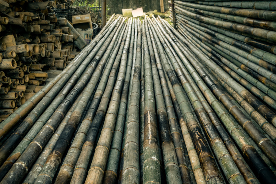
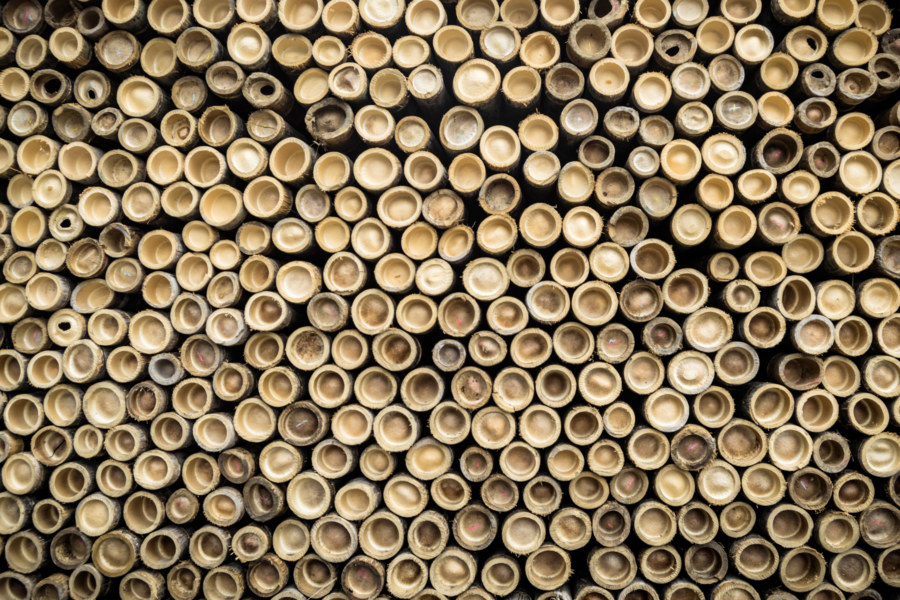
Zhushan (literally “Bamboo Mountain”) is a historic yet obscure township in southwestern Nantou mainly known for cultivating tea and bamboo. The town itself is one of the oldest in central Taiwan but it hardly feels that way. Many of Zhushan’s most historic structures were destroyed or damaged beyond repair in the devastating 921 Earthquake that struck in 1999, which is why its “old street” is lined with modern buildings. Most travellers pass through Zhushan on the way to attractions deeper into the rugged interior of Taiwan without sparing it a second glance—but I stopped for a closer look in the summer of 2017 while on an impromptu road trip. After staying the night in a sleazy love motel never meant for sleep (there was no way to switch off the lights) I wandered around in the morning haze, capturing traces of Zhushan’s history as it disappears into memory.
Zhushan enters recorded history not long after Koxinga 國姓爺, a Ming dynasty loyalist, expelled the Dutch and established the Kingdom of Tungning 東寧王國 in southwestern Taiwan. Koxinga planned to regroup and eventually launch a counterattack against Qing forces in China, but in the meantime his troops needed supplies and something to keep them occupied1. With this in mind the fledgling kingdom decreed the establishment of military-agricultural outposts along the “savage lands” of the frontier, adapting the ancient Chinese túntián system 屯田制 to develop conquered land under military leadership for use in Taiwan2.
In the mid-1660s Lín Qǐ 林杞3, one of the newly-founded kingdom’s generals, and approximately 200 soldiers set out from modern-day Douliu to establish an outpost in the interior. They marched east-northeast to the low hills at the edge of the coastal plains—part of the Ālǐshān Mountain Range 阿里山山脈—and rounded a gap carved by the wide and sluggish Zhuóshuǐ River 濁水溪 (中文), the longest on the island. After crossing the Qīngshuǐ River 清水溪, one of the tributaries of the Zhoushui, the expedition settled in an area of broad, fertile grasslands surrounded by mountains on three sides.
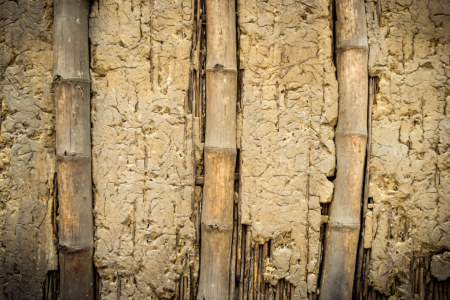
Soon they encountered the Indigenous inhabitants of the area, the Luhtu branch 魯富都社 of the Tsou People 鄒族4, who customarily used the grasslands for hunting, but apparently had no permanent settlement there. The inevitable conflict between the invaders and local Indigenous people prompted Lin Qi to construct a bamboo stockade to defend the outpost, but the Tsou whittled their strength down over the course of several seasons, and eventually defeated the Chinese interlopers. General Li perished in the final battle and the remaining survivors fled westward, carrying with them the memory of his sacrifice to the cause of Han Chinese settler colonialism.
Sometime in the next several decades ethnic Chinese established a market town not far from the site of General Lin’s ill-fated colony. In 1750 the town was brought under Qing administration under the name of Lîm-kí-poo 林圯埔5 (or Línyípù in Mandarin Chinese), which literally means “land developed by Lin Qi”. It prospered as an important trading post on the Qing frontier, which was formally demarcated by the Tǔniú Boundary Line 土牛界線. Ungoverned Indigenous territory was only about a dozen kilometers from the edge of town6.
Prior to Japanese conquest of Taiwan the Qing authorities made an ill-fated attempt to build a walled city on a low hill next to Zhushan, but the project was aborted due to lack of funding and challenging logistics, and nothing remains of what would have become Yunlin City7. In 1920, halfway through the Japanese colonial era, the name was officially changed to Zhushan as part of a massive administrative reorganization and name rectification campaign8. In Japanese times Zhushan continued to prosper as an important center of production for lumber, bamboo, and camphor. Eventually sugar, tobacco, and tea industries were also developed.
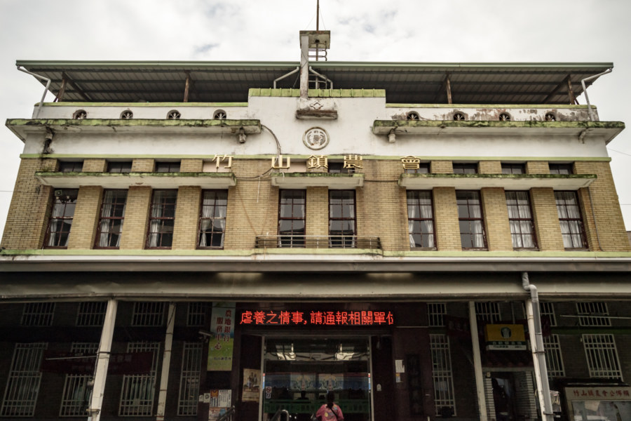
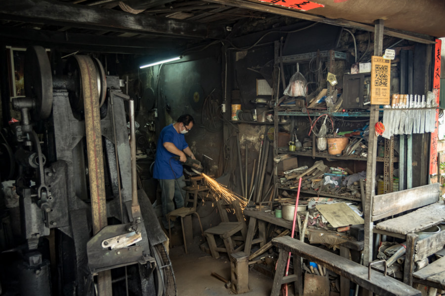
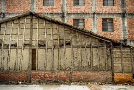
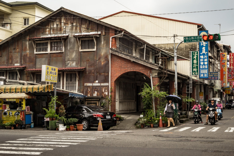
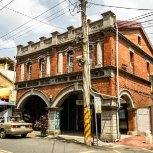
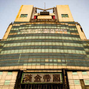
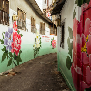
Much of this history is invisible while wandering around the streets of modern Zhushan. Indeed, it is not immediately obvious what distinguishes this place from any of the other small cities scattered around central Taiwan, but there are places where traces of the past are more visible. Nowhere is this more obvious than along Dǎtiě Lane 打鐵巷 (literally “Strike Iron Lane”), immediately opposite the Farmer’s Association. Here the main attraction is Lai Far Blacksmith Shop 來發鋨店9, founded 1881 and still in operation today. It is the last of six or seven blacksmiths that used to ply their trade on this small street, serving the needs of Zhushan’s many farmers.
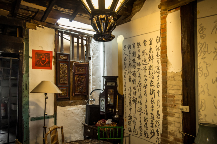
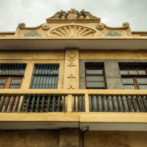
At the end of the blacksmith laneway is an old two-storey residence recently converted into a guesthouse (mínsù 民宿) and gallery space by the name of Zhùgāo Yìlǎng 筑高亦朗. The owner saw me snap a photo of the exterior as I walked by and invited me inside for a closer look. He was passionate about preserving something of the old Zhushan for future generations to see and experience. If you’re considering a stay in Zhushan, definitely look him up!
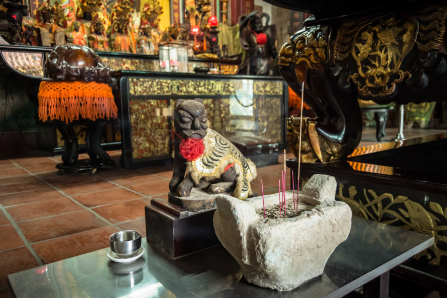
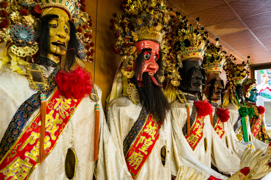
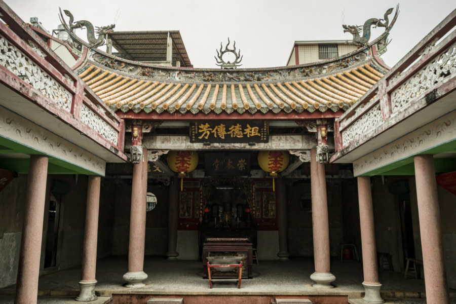
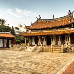
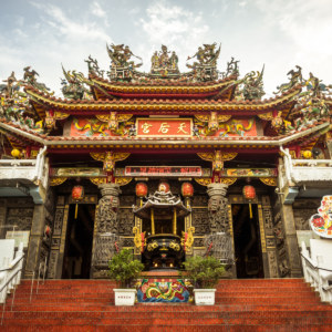
I visited two temples that were interesting enough to warrant including a picture. The first of these was Liánxìng Temple 連興宮, which venerates the Māzǔ 媽祖, patron of sailors, fishermen, and other seafarers. You might wonder about the utility of revering a sea goddess this far inland—but Mazu’s popularity in Taiwan is readily understood as a debt of gratitude for ensuring the safe passage of their ancestors across the treacherous black ditch (hēishuǐgōu 黑水溝, namely the Taiwan Strait). I also had a look at the Língdé City God Temple 靈德城隍廟 to scope out their manifestations of various underworld gods. A chamber next to the main hall caught my eye with its many life-sized puppets depicting Qī Yé 七爺, Bā Yé 八爺, Ox-Head 牛頭, and Horse-Face 馬面.
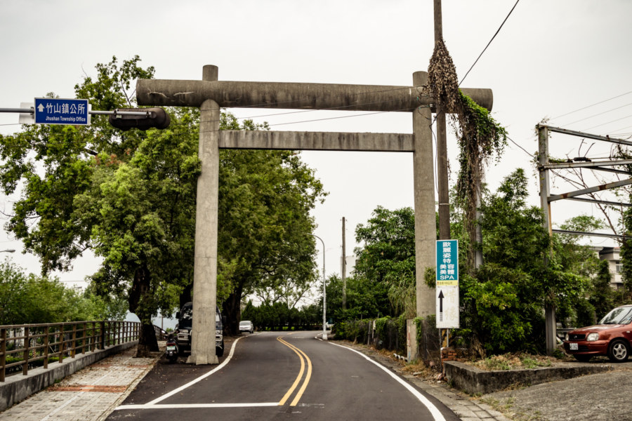
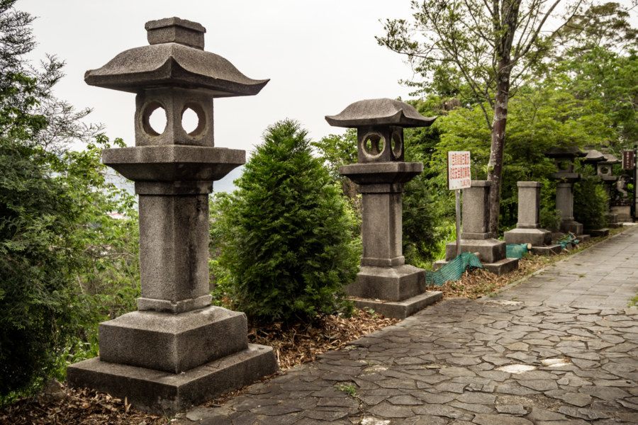
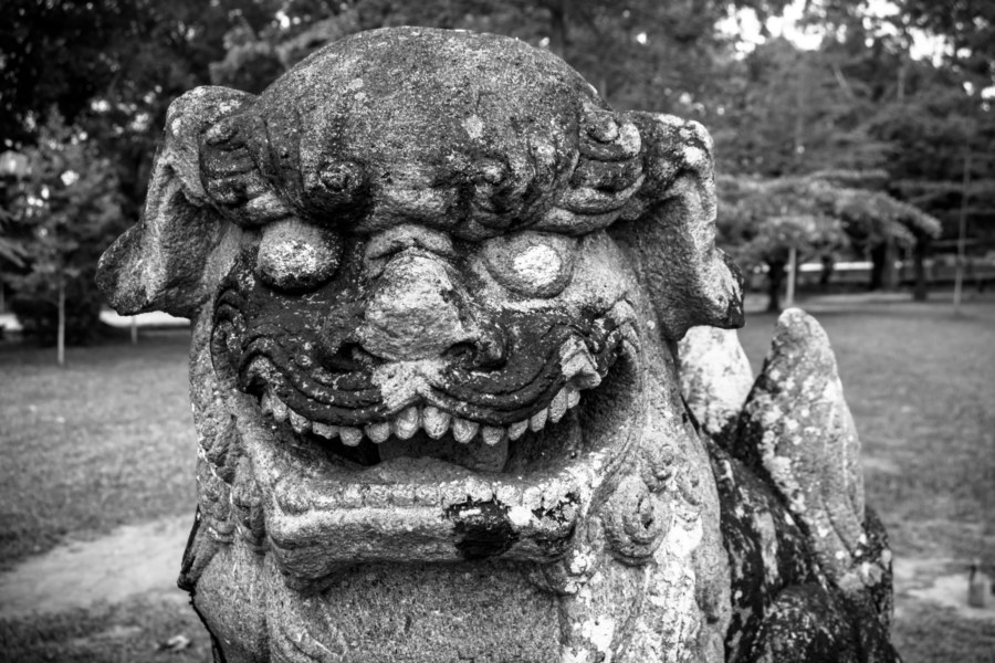
Zhushan Shinto Shrine 竹山神社 was constructed on a low outcrop on the northwestern side of town in 1938 and dismantled in the decades after the war. The original shrine and several associated structures are long gone but many artifacts remain scattered across Zhushan Park 竹山公園 and the surrounding area. The most prominent of these is the torii (鳥居) spanning the road leading to the park—although I’m not sure this is the original or a copy. Inside the park you’ll find numerous stone lanterns (their inscriptions defaced, of course) and a pair of guardian lions.
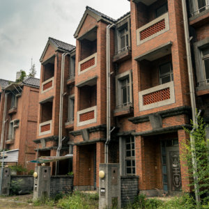
After visiting the Shinto shrine I made a brief, half-hearted attempt to find some trace of the walled fortification built in this area in Qing dynasty times but soon gave up—there’s probably nothing left of it. Heading west and out of town, I went to investigate a poorly-planned subdevelopment near the former Zhushan Sugar Factory 竹山製糖, and soon continued west into Linnei in neighbouring Yunlin.
Thus ends a morning of exploration in an under-appreciated part of Nantou County. If you’re curious about the long and surprisingly rich history of the area I encourage you to browse this Chinese language blog for more information. This series will continue into southeastern Changhua before heading south into Yunlin, Chiayi, Tainan, and Kaohsiung, so stay tuned.
- Koxinga, or Zhèng Chénggōng 鄭成功 as he is known to Taiwanese, perished only six months into his reign, which is formally known as the Ming-Zheng era. The decree mentioned in the text, formally known as “屯田之制,以拓番地” (and sometimes referred to as “寓兵於農,兵農合一”), was made in 1665 by Zhèng Jīng 鄭經, Koxinga’s eldest son and successor. ↩
- The “tun” in tuntian appears in several Taiwanese place names. Caotun, also in Nantou, is one example, and Taichung, traditionally known as Dàtún 大屯, contains several more: Beitun, Xitun, and Nantun. ↩
- Lin Qi’s name is written in a variety of different ways depending on the source—林圮, 林屺, and 林杞, among them. For reasons I don’t yet understand the second character of the town named in his honour is similar to but not one of those variations. Perhaps it is worth noting that Zhushan was a frontier town and not many of its inhabitants would have been literate for much of its early history. ↩
- As with anything to do with Taiwanese Indigenous people there are numerous ways to write the names of the people, their subgroups, and their various settlements. Luhtu also appears as Duhtu in some texts, and the displaced descendants now reside in Wàngměi Village 望美村 as part of the Jiǔměi community 久美部落 in neighbouring Xinyi Township. Jiumei is also written as Mahavun or Mamahavana, presumably variations based on differences between the Tsou and Bunun languages spoken in the community. The Tsou people were once plentiful in Nantou but those residing in Jiumei are the only ones who remain after centuries of colonization, conflict, and displacement. ↩
- Linyipu is a modern Mandarin Chinese reading of the relevant characters; it would be been known as Lîm-kí-poo in the Hokkien of the majority for much of its history. I’ve encountered several other romanizations in my research, for example: Limkepo, Lim Kepeau, Lin Pi Pu, Lin-chi-po, and Lim-ki-pou. ↩
- The boundary system and quarantine policy were established in 1722. At that time the border ran along the break in the hills where the Zhoushui River enters the coastal plains. In 1750 much of modern-day Zhushan came under Qing control. The boundary was amended in 1760 but not until 1782 did it surge east to encompass what is now Lugu and Jiji. There it languished for a century; it wasn’t until 1875 that Shuili and Puli were incorporated into Qing Taiwan. ↩
- Qing governance of Taiwan became much more proactive following the Bāyáowān Incident 八瑤灣事件 (or Mudan Incident in English) (1871) and subsequent Japanese reprisals (1874). Liú Míngchuán 劉銘傳, governor of Taiwan from 1884 to 1891, attempted to modernize Taiwan and shore up its defences, but his projects were chronically underfunded due to a lack of support from the Qing court, and many of them were never completed. What is now known to historians as Yunlin County Old City 雲林縣舊城 was partly constructed on a hilltop northwest of town but doesn’t seem to have been put to any use before it was abandoned. It also sounds as if the Qing realized there were too many logistical challenges involved in supplying the new city due to seasonal flooding along the Zhoushui River. In 1893 a decision was made to relocated the project to Yunlin County New City 雲林縣新城 in modern Douliu, now the capital of Yunlin. Interesting trivia: Yunlin is the only county on mainland Taiwan without an eponymous city—and in an alternate timeline, Zhushan would now be known as Yunlin City! Also worth noting: the vanished city also marks the beginning of the Bātōngguān Old Road, built in 1875 to facilitate passage across the rugged interior to Eastern Taiwan. For a full history of the aborted city in Zhushan check out this post. ↩
- Most names changed in 1920 were considered “indecent” in polite society, with Kaohsiung (formerly Takao) being an obvious example. In this case I wonder if an anti-Japanese incident in 1912 had anything to do with erasing Zhushan’s original name. ↩
- This official spelling is derived from gwoyeu romatzyh, a peculiar romanization scheme that uses letters to represent tone. It was in official use for much of the mid-20th century but fell out of use in the 1970s. ↩
Write a Comment