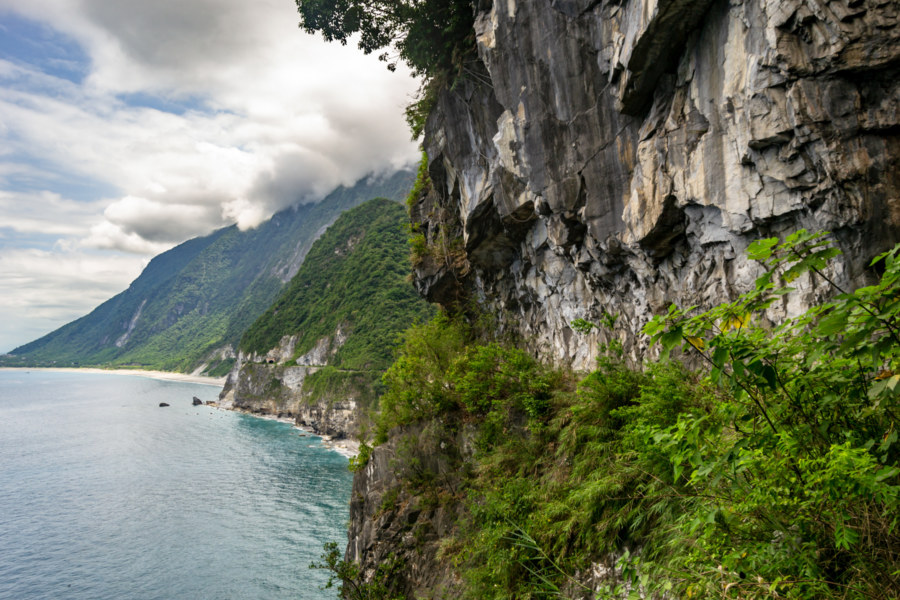
In May 2018 I seized an opportunity to ride the beautiful and dangerous Suhua Highway (蘇花公路) from Hualien City to Su’ao in Yilan. I had previously taken this same route on bicycle back in 2013—a harrowing trip I’ll never forget—so I was eager to drive a scooter and experience it at a different pace. I also visited a number of historic sites along the way, including several former Shinto shrines, as part of an ongoing project documenting various elements of the Japanese colonial legacy in Taiwan. Much of the highway itself also owes something to Japanese engineering, having opened to vehicular traffic in 1931, but it has been continuously repaired and expanded since then.
This collection features content documenting the many natural wonders and awe-inspiring landforms of Taiwan.
Nantou Road Trip 2015: Puli to Sun Moon Lake
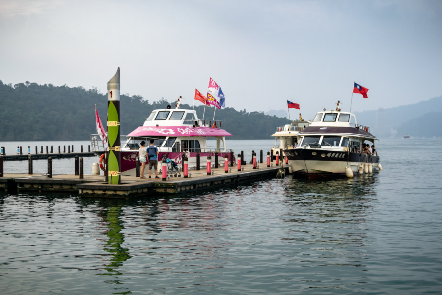
This post gathers photos taken on two scooter rides from Puli to the shores of Sun Moon Lake 日月潭 in Yuchi, part of a multi-day road trip undertaken in late 2015. I didn’t have a chance to explore as deeply as I would have liked, nor did I really know what was so special about this part of the country while I was there, so this post will be somewhat less extensive than most others in this series. I hope to someday return to the Sun Moon Lake area and gather material to make a fully informed post about this fascinating part of Taiwan.
Postcards From Badouzi 八斗子明信片
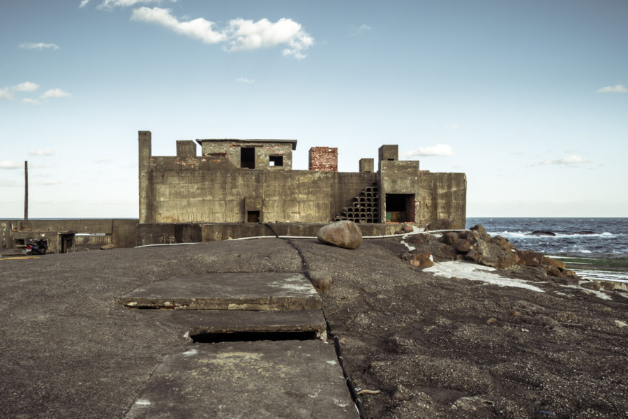
Near the end of my first summer in Taiwan I visited Bādǒuzi (八斗子), a rocky headland, coastal park, and major fishing port at the far eastern edge of Keelung. I went there on impulse, not knowing what to expect, just to see what was out there. Google Maps and Taiwan’s excellent public transit system make random explorations like this almost effortless: pick a point of interest and follow the directions—the digital equivalent of throwing a dart at a map. This post features a selection of retouched photos from this expedition alongside the sort of explanatory text I wouldn’t have been able to write back in 2013. Fair warning for arachnophobes: this post contains several gratuitous photos of giant spiders and other creepy crawlies!
A Foggy Hike in Yangmingshan 陽明山
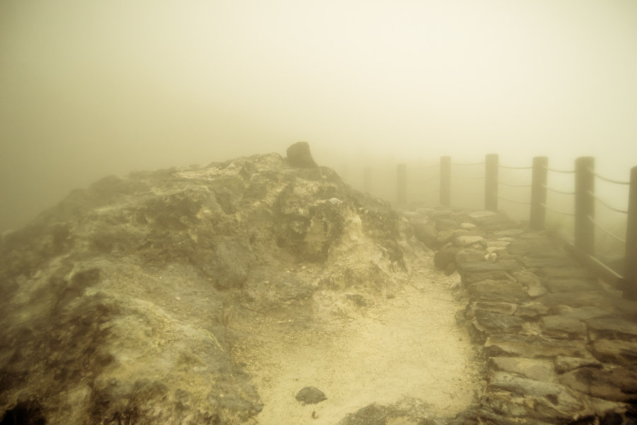
These photographs were taken in early October 2013 while hiking around Yángmíngshān National Park (陽明山國家公園). After meeting up with a friend we took a bus from Jiantan Station in Shilin to Lengshuikeng with the intention of checking out Milk Lake (Niúnǎichí 牛奶湖). Racing up the meandering mountainside roads we soon found ourselves immersed in an interminable fog. Debarking at the bus stop, with hardly another soul around, we decided to wander around and see what we could make of our time in Yangmingshan.
Explorations of the Pacific Edge 1
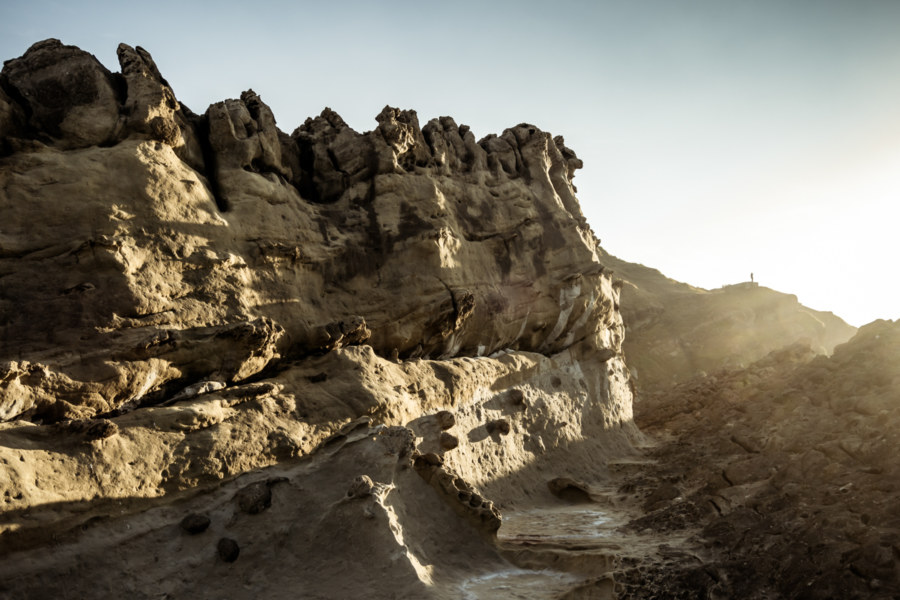
These photos were taken two years ago after cycling through the Old Caoling Tunnel 舊草嶺隧道 into Toucheng, Yilan. The first set of six photos were all shot along the rugged shoreline of the Láilái Geological Area 萊萊地質區 while the last four were captured at Mǎgǎng 馬崗, a half-abandoned fishing village on Cape San Diego 三貂角 (pinyin: Sāndiāojiǎo), the easternmost tip of Taiwan. All were captured in Gongliao. From here the vast Pacific Ocean stretches all the way to Baja California in Mexico.
Crossing the Central Mountain Range of Taiwan 中央山脈機車之旅
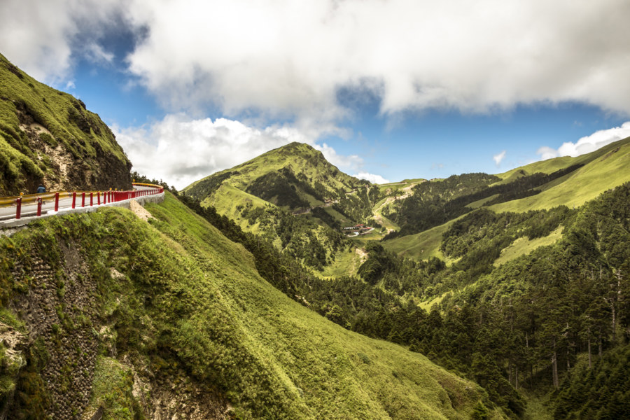
In the summer of 2014 I was nearing the end of my first sojourn in Taiwan. By the beginning of August I would be in Canada for a wedding in the family with no idea what I’d be doing after that. Since I wasn’t sure if I would be returning to Taiwan I made vague plans to go on a road trip. With only about a week to go before my departure the weather took an ominous turn as Typhoon Matmo 麥德姆 barrelled toward the island. On July 20th, with the pressure of time bearing down on us, my girlfriend and I hopped on a 125cc scooter—the same kind of dinky, puttering scooter you see people riding around any Taiwanese town—and set out from Changhua with the goal of crossing the Central Mountain Range 中央山脈 at Wǔlíng 武陵, the highest paved (and publicly-accessible) mountain pass in Taiwan at 3,275 meters above sea level. With luck, time and weather permitting, we’d be able to visit Héhuānshān 合歡山 and maybe even drive down into the amazingly scenic Taroko Gorge 太魯閣峽谷 on the east side of the island.
Exploring the Badlands of Southern Taiwan
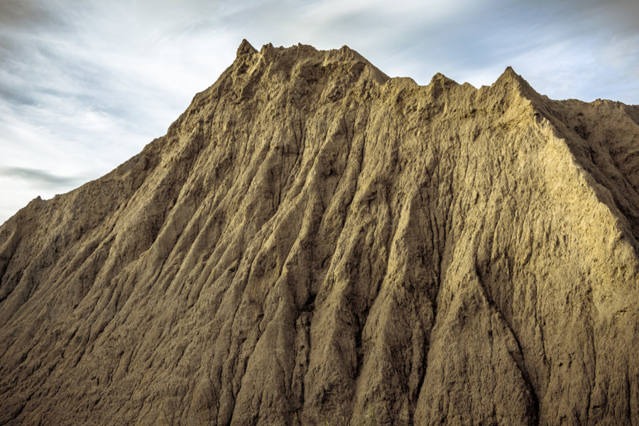
The badlands of Taiwan are one of the nation’s most captivating and unusual landscapes. While there are several scattered around the country the most extensive badlands can be found along the hilly borderlands of Tainan and Kaohsiung. Known locally to Taiwanese as “moon worlds” (yuèshìjiè 月世界), these landscapes are composed of weathered mudstone outcrops that erode too quickly for plants to grow.
Wushanding Mud Volcano 烏山頂泥火山
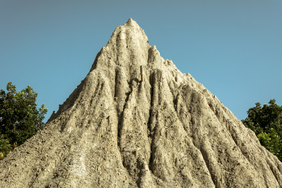
Wūshāndǐng Mud Volcano (烏山頂泥火山) is a modest geological curiosity in the hilly badlands of Yanchao, Kaohsiung. It is the largest and most impressive mud volcano field in Taiwan. I first heard about the place through this excellent article by Richard Saunders, who also published an illuminating article about mud volcanoes in the China Post.
Nantou’s Misty Lotus Forest 忘憂森林
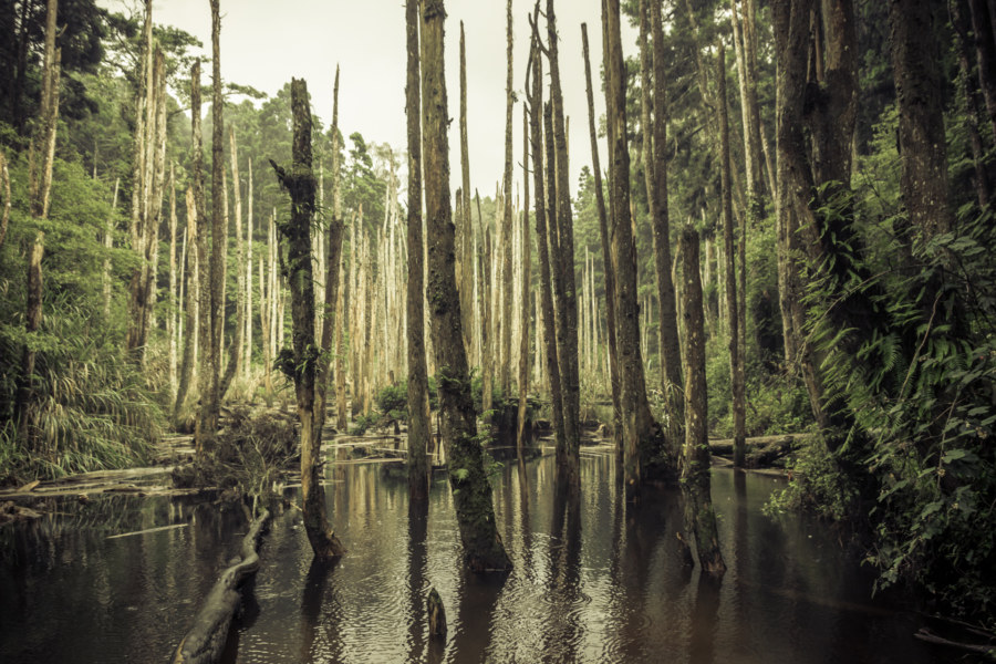
Collected here are a series of dreamlike photos from a road trip into the misty mountains of Lugu in Nantou, central Taiwan. I undertook this trip with a friend in July 2014. Our goal was the Lotus Forest 忘憂森林 (pinyin: Wàngyōu Sēnlín), also known as the Misty Forest 迷霧森林, a high mountain bog formed in the aftermath of the catastrophic 921 earthquake when a landslide altered drainage patterns, forming a small lake and drowning part of the existing forest. At an elevation somewhere close to 2,000 meters, the Lotus Forest is often shrouded in thick fog, imbuing it with an eerie mystique that attracts Taiwanese people from all over the island.
