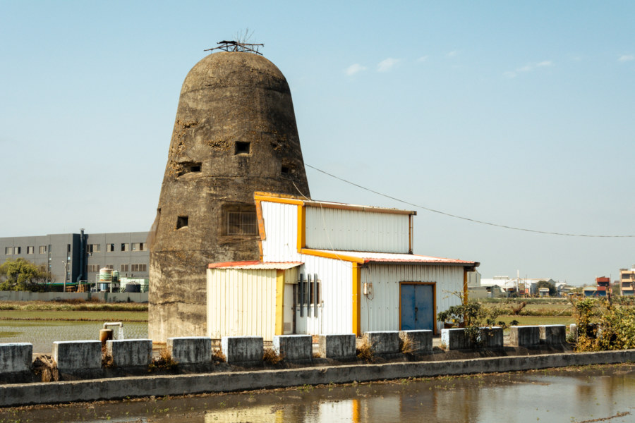
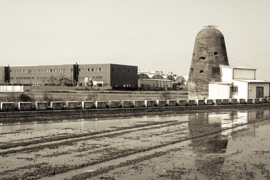
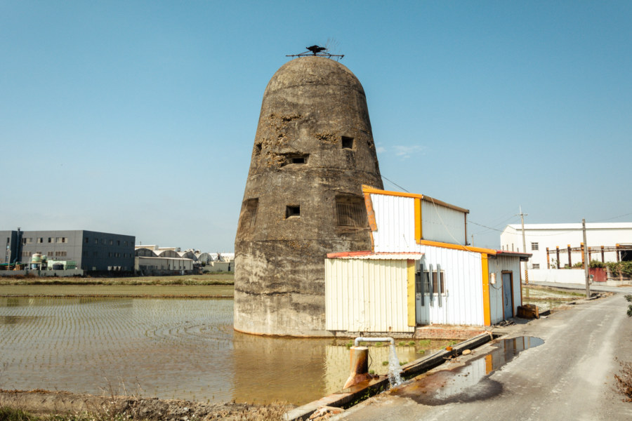
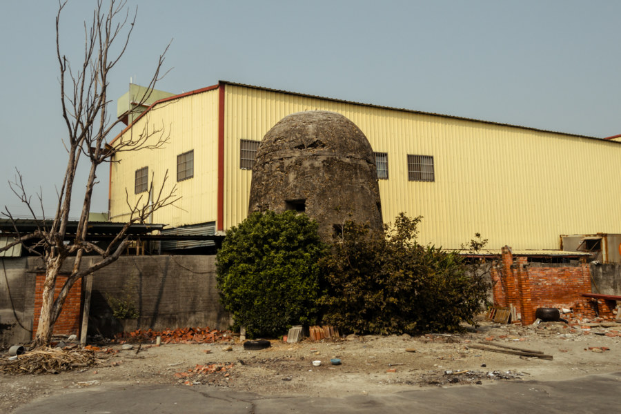
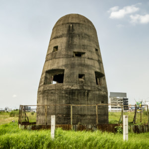
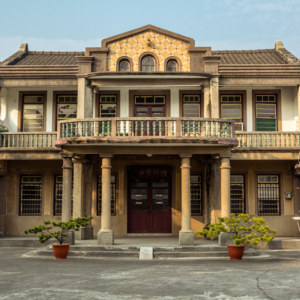
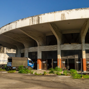
One of my idle pursuits this mild winter has involved documenting all the obscure and unusual stuff I find in my travels around Changhua. When I go riding I prefer to take winding roads that twist and turn through old villages rather than the newer thoroughfares that directly connect communities in the countryside. Sometimes this pays off—for instance, while exploring some of the side roads on my way to Lukang I found this strange looking building amid the rice fields and rural industrial sprawl.
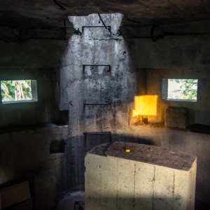
When I am out in the field I seldom have any idea what I am looking at. I don’t speak or read much Chinese, not that it would help in a lot of cases (there being no plaques, markers, or inscriptions at this particular locale, for example). My usual approach is to gather clues with my camera and puzzle things out whenever I get home and feel like messing around. The entire process actually reminds me a lot of the adventure games I used to play as a kid—think of The 7th Guest, Myst, or Castle of Dr. Brain. Something about doing this really appeals to my boyish curiosity.
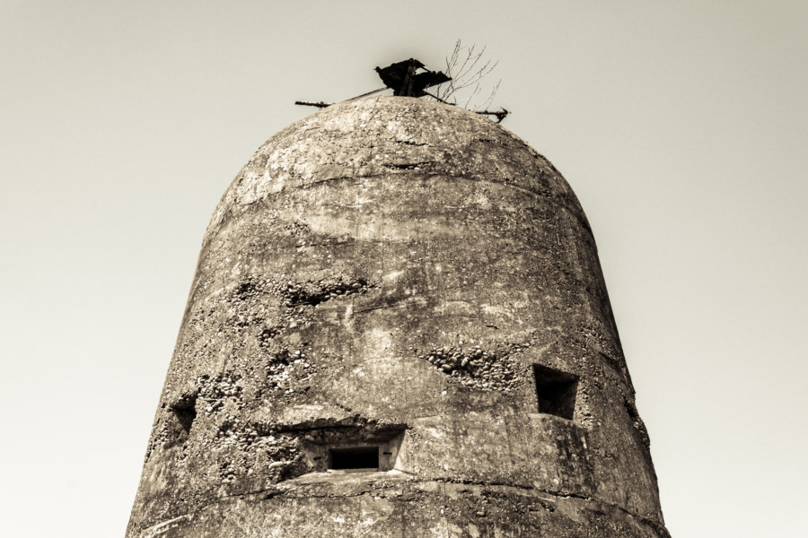
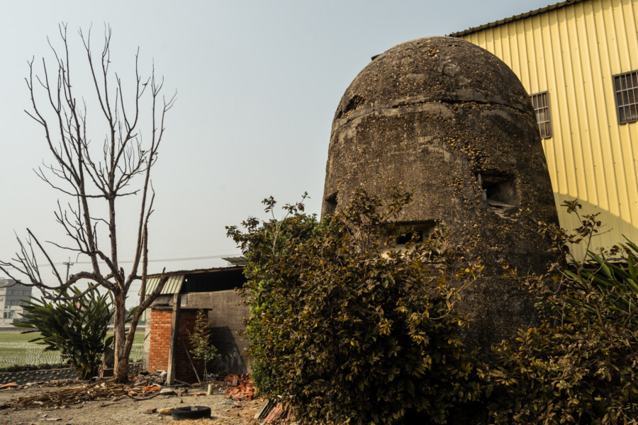
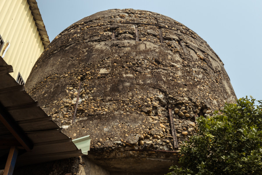
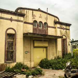
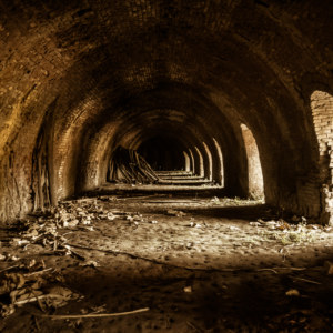
So, what’d I turn up this time? Turns out this structure is a Japanese colonial era fortification built in 1943 to protect Changhua Aerodrome 彰化飛行場 (Shōka in Japanese), an airfield that no longer exists, from attack by allied forces. Known as Gǔpàotái 古砲台 (old gun tower; officially 原福興外埔機場防空砲台), it is located in Fānpó Village 番婆村 in Fuxing, southeast of the city1. Apparently it is something of a tourist attraction (here the local township office calls it “Old Canon Flat” in English) though you wouldn’t know it from the look of the place.
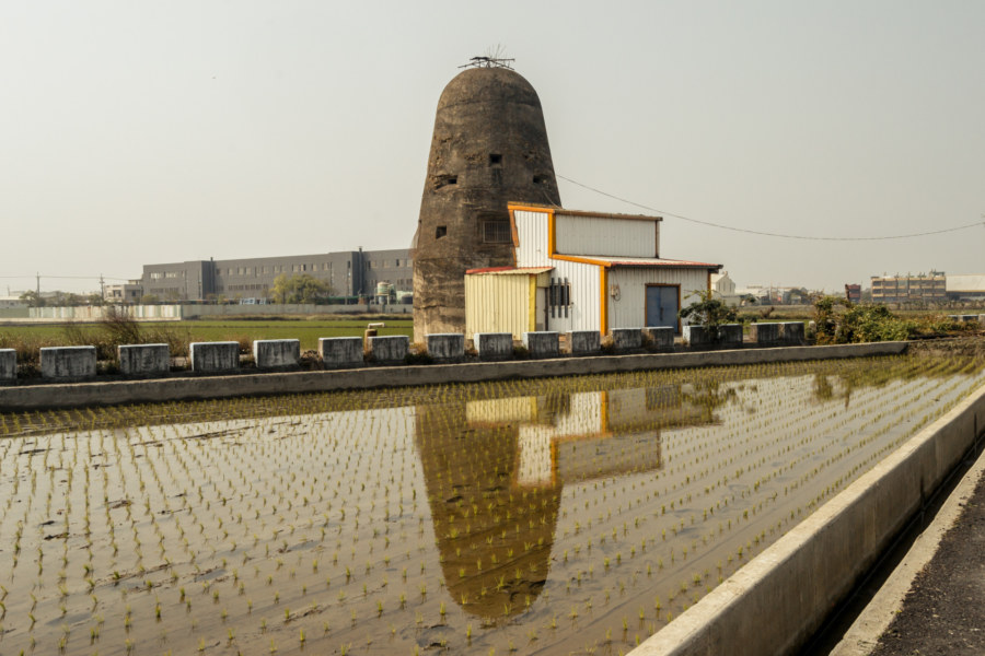
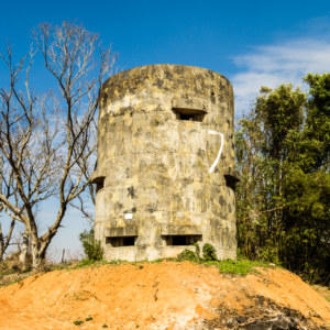
Something else came out of this research: there is a second fortification not too far from this one, barely visible here on Google Street View. In the interest of rounding out this post I ended up making a second trip to the area to find the other, more obscure fortification. This one is on private property but some old men by the roadside waved me on in amusement. I don’t imagine many people come by here inquiring about this old ruin!
So there you have it: the last remnants of a Japanese colonial era airfield in Changhua identified and described. Only a few more to go before I level up!
- Technically these fortifications are located in Fuxing, the township immediately to the south of Lukang, which was known as Rokkō in Japanese times. American military maps occasionally listed this place as the Rokko Aerodrome as a result—but the actual historic name appears to be the Changhua Aerodrome. ↩

I wonder if you saw Michael Turton’s post on Japanese era airfields post?
http://michaelturton.blogspot.com/2015/03/1945-us-maps-of-japanese-airfields-in.html
Might be cool if you were able to somewhat match them up.
Yes, his post was the impetus for this one. I had the photos laying around but didn’t know what they were all about until looking up some the names on the maps he posted. (There’s a link in the body of the post above to Michael’s original post—maybe a bit subtle.)
No, no, my fault. Was reading it through my phone and didn’t click through the links. :D
Cool. This would be fun. I love old things.